2 New Geologic Videos & 1 New Geologic Map
The Geological Society of America’s Connects 2020 (GSA-2020) virtual conference went off as scheduled last week and AZGS was there, virtually. There were, of courses, minor issues with the technology, but the presenters and presentations were generally excellent.
AZGS staff, J.P. Cook, B.F. Gootee, and F.M. Conway, P.A. Pearthree, A. Zaffos, and R. Bellassai co-authored two presentations. Because this was a virtual conference, presentations and posters were videotaped in advance and presented as scheduled by GSA staff. The two AZGS presentations are now available at the AZGS YouTube channel for viewing at your convenience. The Cook-Gootee presentation is 13.5 minutes in length; Conway and others e-Poster is 6.3 minutes long. The two abstracts are reproduced below in their entirety.
- Landslide Mapping along the Interstate-17 corridor, central Arizona (Cook and Gootee) (13.5 minutes);
- Arizona Geological Survey’s outsized impact on Arizona’s economy 2019 – e-Poster (Conway & 7 others) (6.3 minutes)

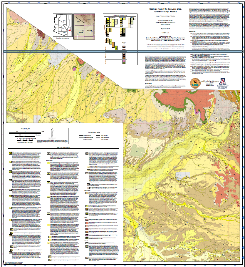
Newly Released Geologic Map.
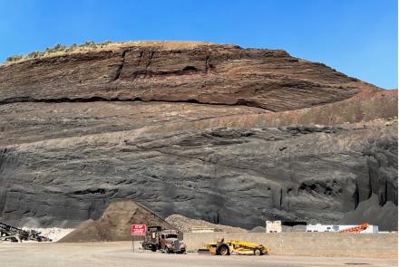
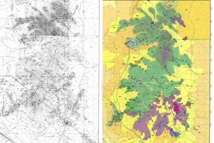
On Monday (2 Nov.) we released our newest geologic map: Geologic map of the San Jose area 7.5' Quadrangle, Graham County, Arizona. The map illustrates the complexity of Quaternary sedimentary deposits of the eastern Gila River Valley in the Basin and Range Province, which is bounded on the north by the Gila Mountains, on the east by the Peloncillo Mountains, and to the southwest by the Pinaleño and Santa Teresa Mountains. The Safford Basin initially formed during mid-Tertiary extension along with the formation of metamorphic core complexes and low angle faulting (e.g., Spencer and Reynolds, 1989).
GSA2020 Connects Abstracts
Title: Landslide mapping along the Interstate 17 corridor, central Arizona
Session: Engineering Geology discipline in the Landslide Hazard and risk assessment
Authors: Cook, Joseph P. and Gootee, Brian F., Arizona Geological Survey
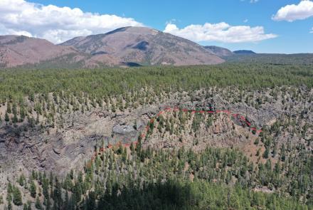
Landslides occur in a variety of landscapes and geologic settings throughout Arizona. Prior to 2015, our knowledge of the number and distribution of these slides was limited and scattered across many geologic maps and reports. In 2015 the Arizona Geological Survey (AZGS) compiled the Arizona Statewide Landslide Inventory Database (AzSLID) which included all known mapped and published landslide deposits throughout Arizona. Many additional, previously unmapped landslides were identified in aerial imagery and topographic data during this process. These interpreted features were included in AzSLID but no field verification was conducted.
In 2019, AZGS began a new project to study the character and extent of landslide deposits along I-17 from Anthem to Flagstaff, using a combination of field mapping and high-resolution topography. This study area was chosen because of the potential high impact landslides may have on existing infrastructure as well as upcoming plans to expand I-17 near Black Canyon City; an area with many mapped landslides. Damage to roadways by landslides can be catastrophic and extremely expensive to repair and mitigate. In 2008, a section of AZ State Route 87 was damaged by a reactivated portion of a larger slide cut by the road. In 2013, a similar failure within the Bitter springs landslide resulted in the destruction of a portion of US 89. Assessment, repair, and reroutes associated with these events totaled $18M, and $60M, respectively.
The results of this study include verification of interpreted AzSLID landslides, more detailed and refined mapping and descriptions of landslide deposits, and discovery of previously unknown landslide deposits. Clusters of landslide deposits were encountered where the geologic setting was favorable, generally along the edges of high-relief mesas with erosion-resistant caps overlying unconsolidated sediments. Notable new landslide locales include the Verde Valley and Lake Mary fault zone in upper Walnut Canyon. These improvements to our knowledge of landslides in high-impact areas along I-17 will be useful for hazard assessment and planning. All landslide mapping is available for viewing and download on the AZGS Hazard Viewer online.
Title: Arizona Geological Survey’s Outsized Impact on Arizona’s Economy 2019
Session: Economic and Societal Benefits of Geologic Maps and Geologic Data
Authors: Conway, F.M., *Liuzzo, C., *Bartels, A., *Brands, C.C., *Yashi, A., Pearthree, P.A., Zaffos, A., and Bellassai, R. (*UArizona Eller College of Management, Tucson, Arizona)
Geologic maps, data, and reports produced by state geological surveys are undervalued in light of their contribution to state economies and constituent needs. In Spring 2019, we participated in a three-prong study - 1) 31-question survey tool, 2) web analytics of AZGS web resources, and 3) interviews with stakeholders from mineral exploration, federal and state government, hydrogeology, environmental consulting, academia and mining archaeology, - with graduate students of the UArizona Eller College of Management to quantify the impact of products and services of the Arizona Geological Survey (AZGS) on the Arizona economy.
This study documented a $30.4M annual value of the products and services of the AZGS to geotechnical and mining industries and government agencies – a 30-fold return on the survey’s FY-2019 state allocation of $941k (AZGS external grants for 2019 totaled $1.4M). 85% percent of survey respondents (n=176) indicated that reduced access to AZGS products and services would make Arizona a less desirable location for geologically-related economic activity; 80% stated that AZGS digital maps and reports were essential to their organization. Respondents reported that no other agency or entity provides such freely available, high-quality geologic products and services for Arizona. Importantly, small- and medium-sized geotechnical firms noted that AZGS geologic products and services make them more competitive.
AZGS products help fuel Arizona’s economic growth, enhance the competitiveness of small- and medium-sized geotechnical firms, support sustainable natural resources development, improve public safety, and make public administration more effective and efficient. The outsized impact of state geological surveys on state economies, in the case of Arizona a cost-benefit ratio of ~ 30 to 1, makes a strong case for robust state funding for geological surveys.