Examining a small rockfall along the I-17 corridor
Subject: Summary of observations of rockfall along Highway I-17 southbound, mile-marker 250, that occurred ~4:30 a.m. 12/28/19.
This is a brief summary of observations of a rockfall that occurred around 4:30 am on Dec. 28, 2019. These observations were made following a site visit by Brian Gootee (Arizona Geological Survey - AZGS) with Arizona Dept. of Transportation (ADOT) personnel on 12/30/19. Debris was moved off the highway on 12/28 in order to reopen I-17 and removed on 12/30 from the inside shoulder and ditch. Additional field observations were conducted by AZGS staff the week of Jan. 6, 2020.
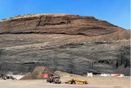
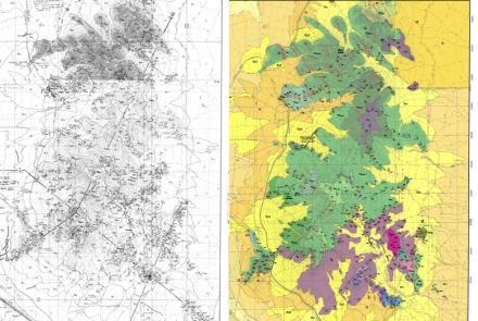
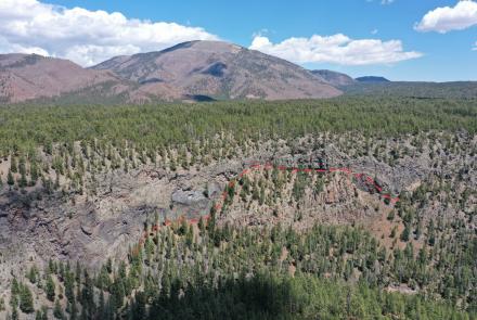
The rockfall failure was restricted to the roadcut in weathered and metamorphosed Proterozoic granitic rock (Xt) and diabase (Xdb), or basement, which is highly fractured and exhibits near-vertical foliation and shear oblique to the roadcut. The rockfall measures about 75 ft (23 m) in height, 52 ft (16 m) wide at the head of the rockfall scar, and around 32 ft (9.7 m) wide at the base near the base of roadcut (Figure 1). Possible factors leading to the failure include approximately 1.8 to 2.2 in of rainfall that fell between Cordes Junction and New River between Dec. 24th and 27th combined with the steep slope of the roadcut. We deployed a small unmanned aerial vehicle (UAV) to document the rockfall and surrounding area for potential landslide features along the roadcut, along the crown ditch above the roadcut, and hillslope up to Black Mesa. No open cracks or fissures were observed via UAV on the hillslope above the rockfall or in the crown ditch.

Between New River and Cordes Junction landslides are common in Neogene basalt flows (Tb) and associated deposits (Ts) that overlie basement rock (Figure 1). This portion of I-17 has been previously investigated and mitigated for slope failure in March 2010, not related to this rockfall event (Terracon, 2008; Wood, 2019) (outlined in Figure 1). Basement rocks were mapped by Anderson (2017), and by Ferguson (2007) south of this area, however, overlying Neogene and Quaternary deposits in this area have not been mapped in detail. Field mapping above the roadcut revealed late Pleistocene Quaternary colluvial (Qc) deposits with variable clay content are present on the hillslope above the crown ditch and below capping basalt (Figure 1). A head scarp is outlined by a 1 to 1.5 meter vertical face and wedge-fissure, filled with debris and vegetation, and cuts across Qc deposits (about 0.5 to 1.5 meters thick). Some vegetation is disturbed, and hydraulic piping is present, however, this feature is visible in 1992 Google Earth imagery, suggesting minimal movement since then. Translational movement of Qc deposits is suggested and may be an indicator of similar types of small-scale movement in this setting. The northernmost extent of this roadcut also marks a boundary where Neogene basalt and sediments are exposed along the highway, and Xt bedrock is exposed along several roadcuts south to about mile-marker 248.
This assessment is the result of collaboration between AZGS and ADOT and is related to ongoing mapping by AZGS of landslides in the I-17 corridor between Flagstaff and Phoenix, funded by the Arizona Department of Emergency and Military Affairs (DEMA).
By Brian Gootee, AZGS Research Scientist


