StoryMaps - a brave new tool for geoscience outreach
Got a geology story to tell? ESRI's StoryMaps might be just the platform you are looking for.
StoryMap technology yields engaging mixed media products layered with interactive maps, images and videos. The American Geophysical Union’s 'The Plainspoken Scientist’ blog (#AGU) published a 3-part story in the first week of Jan. 2018 (1, 3, and 5 Jan) on how and why state geological surveys are leveraging StoryMaps to inform the public, civil authorities, and decision makers about some of the socio-economic impacts of geology in their states.
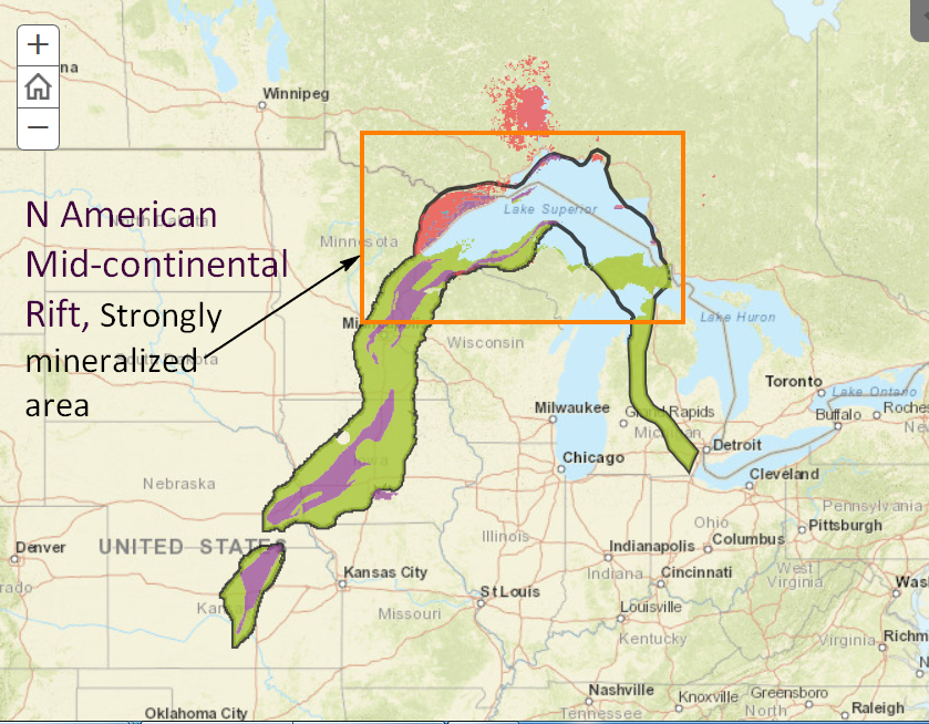 Just this morning, the US Geological Survey released a new StoryMap, ‘Mineral Deposits of the Midcontinent Rift System’. About 1.1 billion years ago tectonic forces were ripping the North American continent in half – for a modern analog think East African rift zone. The rifting process failed but not before a wealth of metallic mineral deposits – nickel, native copper, copper sulfide, silver, uranium, iron oxide, cobalt … - were emplaced along the northern section of the rift zone (Fig. 1).
From the 3rd part of the Plainspoken Scientist’s blog, ‘State geologic surveys are jumping – both feet forward – into the StoryMap milieu. So, this may be the ideal time to partner with teachers, ecologists, and social scientists to frame the intellectual foundation underpinning StoryMap applications to issues of geologic hazards, environmental geology, urban geology, and applications of geoscience to social justice.’
StoryMaps could prove to be one of the best most effective means of informing people about the role that geologic survey’s play in communicating the impact of geologic features and processes on human society.
Posted M. Conway (26 Jan. 2018)