USGS, AZGS, & UArizona Geosciences collaborate on post-wildfire debris flow research in the southwest
AZGS Senior Research Scientist Ann Youberg and Luke McGuire (UArizona Dept of Geosciences), along with their partner Francis Rengers (US Geological Survey), are monitoring and modelling post-wildfire debris flows and associated geologic hazards in Arizona and western New Mexico.
Their data on post-wildfire debris flows of the Woodbury Fire in Arizona’s Tonto National Forest informed the US Geological Survey's Woodbury Fire Debris Flow: A Geo-narrative by Jaime Kostelnik, Lisa Wald, Robert Schmitt, and Francis Rengers.
Background: Woodbury Wildfire & Debris Flow
From the USGS Geo-narrative, “On Saturday, June 8, 2019 at approximately 1:30 PM MST, the Woodbury wildfire ignited approximately 8 kilometers (km) northwest of Superior, Arizona. The 7th largest wildfire in Arizona’s recorded history, the fire burned 501 sq. km [123,875 acres; 194 sq. miles] prior to containment on July 15, 2019.”
‘In September 2019, Pacific Hurricane Lorena moved up the Gulf of California and transitioned into a dissipating tropical storm that moved over the Woodbury burn area, resulting in a significant rainfall event on the morning of September 23, 2019. The most intense rainfall occurred between 7:00 AM and 8:00 AM MST, with peak 15-min rainfall intensities of 86.7 mm h-1.’
‘The heavy rain led to episodes of flash flooding and debris-flow activity from Tortilla Flat eastward. At 6:05 AM MST, the Fish Creek USGS stream gage 8 km east of Tortilla Flat reported an increase in stream stage from 1 m to approximately 3 m.’
Online Resources
USGS Geo-Narrative: https://landslides.usgs.gov/storymap/woodbury/
Read more: After wildlife how intense does rainfall need to be to cause debris flow.
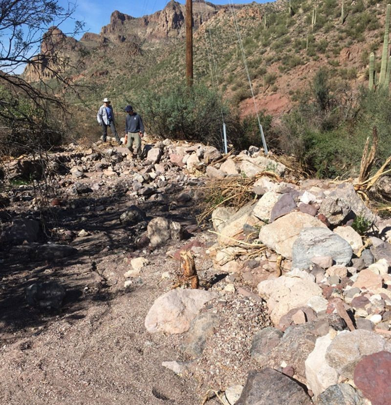
Cover Photo: Debris-flow channel flanked by a boulder levee composed of sediment ranging from 0.1-1.0 m in length. Flow direction is from the top to the bottom of the photo. (Francis Rengers, USGS)


