Geologic Strip Map from Kingman to Bill Williams - Online
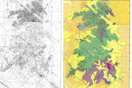
In the 1980s, the Los Alamos National Laboratory (LANL) was keen on searching for hot, dry rock geothermal resources in the Aquarius Mountains of western Arizona. To facilitate exploration, LANL geoscientists Fraser Goff, Andrea Eddy and Barbara Arney produced a geologic strip map stretching from Kingman east to Bill Williams Mountain, Arizona. Originally published in 1983, Steven Reynolds included LANL mapping while compiling the Geologic Map of Arizona (1988).
The original geologic strip map is difficult to find and may only(?) exist in paper form. With encouragement from Fraser Goff (LANL, retired) and Steven Reynolds (Arizona State University), we scanned the five map sheets and uploaded them to the AZGS Document Repository for the benefit of Arizona’s geosciences community.
The map footprint is approximately 10 km (6.2 miles) north to south and 160 km (~100 miles) from west to east and from 114.0833W to 112.1666W; and 35.29166N to 35.01466N.
Map sheet footprint from west to east. Each map sheet is accompanied by a W-E cross section.
- Sheet 1: Kingman to Black Mesa (114.083W to 113.625W and 35.250N to 35.125N)
- Sheet 2: Tin Mountain to Cross Mountain (113.625W to 113.250W and 35.125N to 35.625N)
- Sheet 3: Cross Mountain to Big Chino Valley (113.125W to 112.625W and 35.014 to 35.250N)
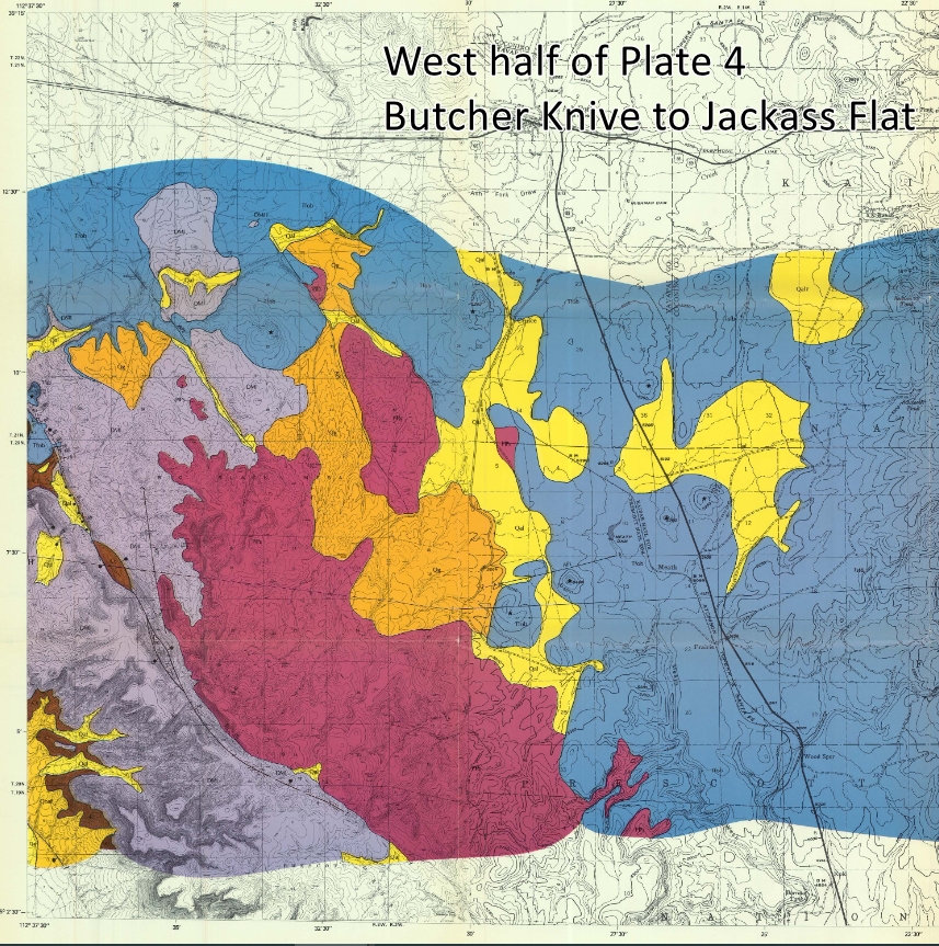
- Sheet 4: Butcher Knife to Jackass Flat (112.625W to 112.1625 and 35.0416N to 35.250N)
- Sheet 5: Description of map units, correlation of map units, and discussion and resources.
The geothermal research program driving the search for hot dry rocks in the Aquarius Mountains fizzled out in the early 1980s before drilling could get underway (F. Goff, pers. Comm, August 2021).
Resources
Aiken, C.L.V., and Ander, M.E., 1981, A regional strategy for geothermal exploration with emphasis on gravity and magnetotellurics: Journal of Volcanology and Geothermal Research, v. 9, p. 1-27.
Goff, F.E., Eddy, A.C. and Arney, B.H., 1983, Reconnaissance Geologic Strip Map from Kingman to South of Bill Williams Mountain. Los Alamos National Laboratory, LA-9202-Map, 5 sheets, scale 1:48,000.
Goff, F.E., Eddy, A.C. and Arney, B.H., 2021, Reconnaissance Geologic Strip Map from Kingman to South of Bill Williams Mountain. Arizona Geological Survey Contributed Map CM-21-B, 5 sheets, scale 1:48,000.
Goff, F.E., Arney, B.H., Aiken, C., West, F.G., and Eddy, A.C., 1979, Preliminary evaluation of the Aquarius Mountains hot dry rock geothermal prospect, Arizona. Geothermal Resources Council Transactions, vol. 3, p. 257-260.
Goff, F.E., 1979, "Wet" geothermal potential of the Kingman-Williams region, Arizona. Los Alamos Scientific Laboratory Informal Report LA-7757-MS, 25 p. w/ map.
Reynolds, S.J., 1988, Geologic Map of Arizona. Arizona Geological Survey Map-26, 1:1,000,000 map scale.
West, F.G. and Laughlin, A.W., 1979, Aquarius Mountain Area, Arizona: A Possible HDR Prospect. Los Alamos National Laboratory, LA-7804-MS (Informal Report), 22 p.