NEW Digital Geologic Maps in 2022: Mohave and Graham Counties
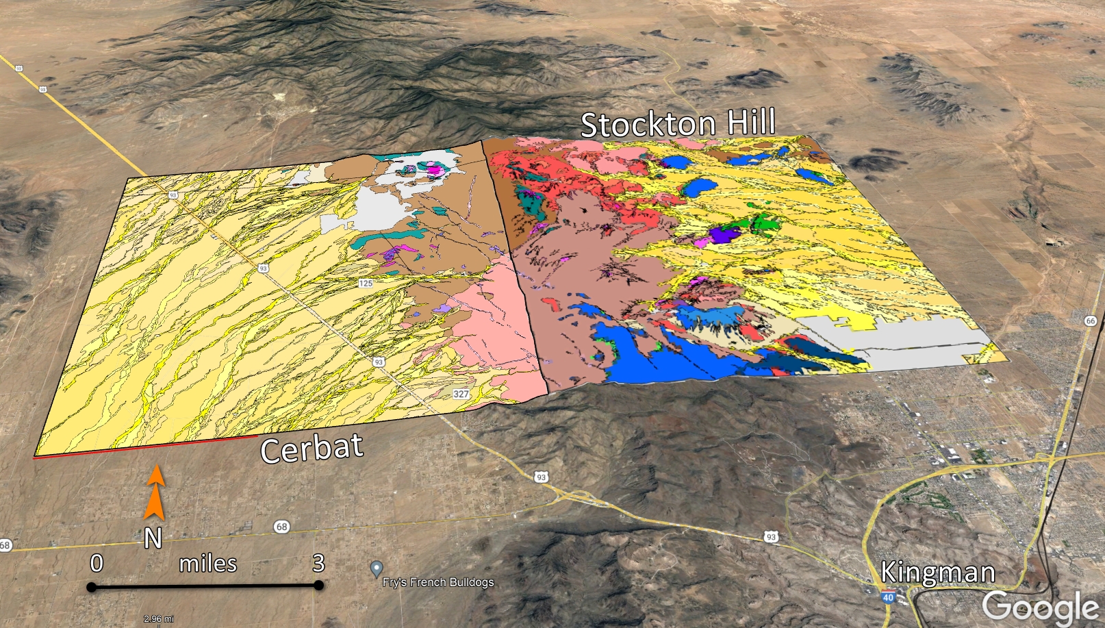
AZGS has released four 1:24,000 scale digital geologic maps (DGM) in 2022. The four maps include two adjacent quadrangles in Graham County (Figure 1) and two adjacent quadrangles in Mohave County (Figure 2). Each map is accompanied by a high resolution PDF, GeMS geodatabase, Google Earth KMZ (Figures 1 and 2), a geopackage, an open-source version of gisdata, and a simplified version of the geodatabase. And each DGM includes at least one cross section.

The Cerbat geologic quadrangle is accompanied by a 21-page report and includes a brief description of the Emerald Isle copper deposit along with some production values of are included.
Citations and Active Links to Digital Geologic Map Products
- Johnson, B. J., Pearthree, P. A., Richardson, C. A., and Ferguson, C. A., 2022, Geologic map of the Stockton 7.5' quadrangle, Mohave County, Arizona: Arizona Geological Survey Digital Geological Map DGM-152, scale 1:24,000, 2 sheets, and text http://repository.azgs.az.gov/uri_gin/azgs/dlio/2016
- Richardson, C. A., and Pearthree, P. A., 2022, Geologic map of the Cerbat 7.5' quadrangle, Mohave County, Arizona: Arizona Geological Survey Digital Geological Map DGM-151, scale 1:24,000, 20 p. text http://repository.azgs.az.gov/uri_gin/azgs/dlio/2011
- Gootee, B. F., and Cook, J. P., 2022, Surficial geologic map of the Shingle Mill Mountain and eastern part of the Tripp Canyon 7.5' quadrangles, Graham County, Arizona: Arizona Geological Survey Digital Geological Map DGM-150, scale 1:24,000, 2 sheets. http://repository.azgs.az.gov/uri_gin/azgs/dlio/2015
- Gootee, B. F., and Cook, J. P., 2022, Geologic map of the Eden and eastern half of the Telegraph Wash 7.5' quadrangles, Graham County, Arizona: Arizona Geological Survey Digital Geological Map DGM-149, scale 1:24,000, 2 sheets. http://repository.azgs.az.gov/uri_gin/azgs/dlio/2012

Figure 2. Geologic map of Cerbat and Stockton Hill 7.5' quadrangles in Mohave County as depicted on Google Earth.


