AZGS is releasing 33 analog geologic maps as digital geologic maps in Fall 2022.

The summer 2022 issue of the Arizona Geology Newsletter, V43, #1 is available online.

AZGS launched an enhanced enhanced and improved online geologic map of Arizona.

Four digital geologic maps released in 2022.

Recent AZGS publications focusing on the geology of the Organ Pipe Cactus National Monument.
New Contributed Report on the geology and geochronology of four 7.5’ quadrangles in SW Arizona and SE California.
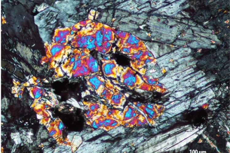
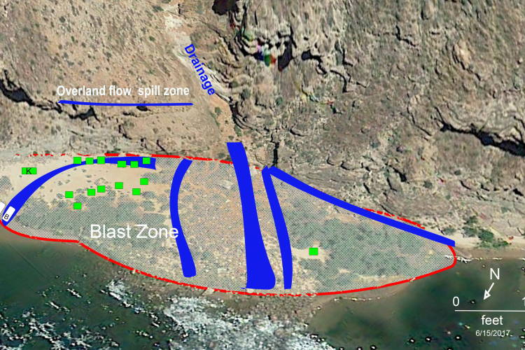
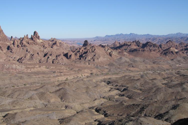
The Orocopia Schist exposed at Cemetery Ridge, western Arizona.

Free online resources served by the Arizona Geological Survey.

A fresh, holistic Grand Canyon Stratigraphy.
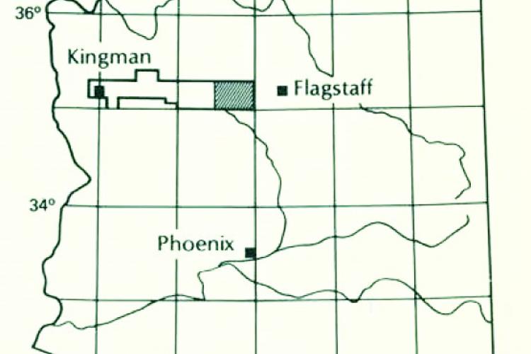
Geologic strip map from Kingman to Bill Williams Mountain, Arizona.