When the ground comes tumbling down: Subsidence that accompanies block caving
An example from the San Manuel Mine near San Manuel, Arizona
Block caving involves undermining the vertical support of the ore column, which then undergoes gravitational collapse (carousel slide 1).
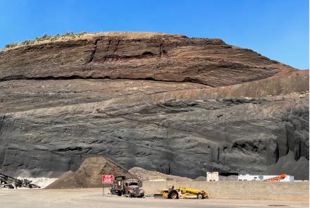
Read more at: https://vwo.com/blog/image-slider-alternatives/?utm_campaign=tof_ugc). The broken ore is then extracted by conveyer or ore cars and delivered to a site, frequently on the surface, where the ore is separated from the gangue (rock with little economic value).
Ground subsidence accompanies block caving as the overlying mine roof strata bends before slowly collapsing into the growing void. The San Manuel copper mine, located about 3 miles WSW of Mammoth in the San Pedro Valley of southeastern Arizona, provides an example of the ground subsidence that accompanies block cave mining.

Block caving has been used in low-grade porphyry copper mines since the early part of the 20th century (Allen, 1914). The area of ore extraction was divided into rectangular blocks that were mined in a checkerboard sequence with all the ore in a block being removed before an adjacent block was mined. Block caving has fallen out of favor as other extraction techniques, such as the panel system, has proved more efficacious. In terms of production costs, however, block caving is more expensive than open pit mining and is restricted to projects where stripping costs would be prohibitive.
The San Manuel block caving operation began on 24 Nov. 1955. Dave Briggs, geologist and mining historian, published a short report on the History of the San Manuel-Kalamazoo Mine, Pinal County, Arizona, that includes a section on block caving. By the late 1970s Magma Copper reduced block caving extraction in favor of open-pit mining. From 1986 to 1994, open pit mining supplemented block caving operations by chiefly extracting shallow oxide ores from the zone above the block caved sulfide zone.
The San Manuel – Kalamazoo copper deposit produced approximately 703,686,000 short tons of sulfide ore, averaging 0.66% copper from it’s underground operations. Once the largest underground mining operation in North America, all underground mining and milling operations ceased in June 1999. From June 1999 until March 2002, limited SX-EW copper production from in-situ leaching and rinsing existing heap leach pads continued. By Jan. 2002, all production had ceased and the mine and surrounding area were prepared for reclamation (Briggs, 2014).
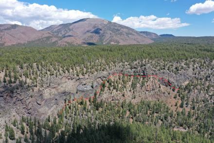
Using Google Earth to identify temporal changes block caving collapse. Google Earth provides 17 time series images from 1992 to 2019 for the San Manuel Mine area. Evidence of subsidence due to block caving collapse appears in the earliest image. Four years later, in May 1996, presents a stark difference with an increase in fractures and small, fault-bounded blocks within the collapsed zone. Visual differences with later images, through May 2019, seem, in comparison, to be subtle and minor.
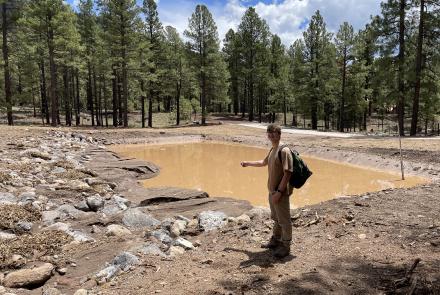
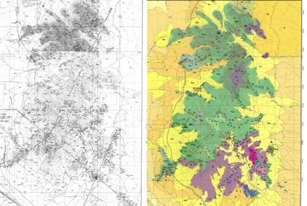
The collapse zone has a perimeter of 1.8 miles with an area of 0.20 square miles. The magnitude of ground subsidence is undetermined. The final figure illustrates the approximate number and orientation of major and minor fractures within the collapse zone. The fractured rock steps down to the northeast culminating along the east wall of the open-pit mine.

The future of block cave mining in Arizona. Block cave mining may return to Arizona in the near future. Rio Tinto’s Resolution porphyry copper project near Superior, Arizona, with ore situated 7,000 feet below the land surface, is planning, once permitted, to use block caving to extract the ore. One of the chief environmental concerns is the footprint of ground subsidence in the historic Oak Flats recreation area. For information about the Resolution project and Rio Tinto development plans, visit their website (https://resolutioncopper.com/ ).

Acknowledgments. I thank Dave Briggs for reviewing this post, providing the title slide, and for sharing production data for the San Manuel operation.
Resources
- Allen, C.A., 1914, Methods and economies in mining. Transactions of the American Institute of Mining Engineers, p. 2122 – 2161.
- Bregel, E., 2016, Resolution Copper Mine: Venturing 7,000 feet below Earth's surface. Tucson Daily Star, 4 June 2016. https://tucson.com/news/resolution-copper-mine-venturing-feet-below-earth-s-surface/article_44ca18f8-7a29-5562-9833-dd6611c968fc.html
- Briggs, D.F., 2014, History of the San Manuel-Kalamazoo Mine, Pinal County, Arizona. Arizona Geological Survey Contributed Report, CR-14-A, 9 p. http://repository.azgs.az.gov/uri_gin/azgs/dlio/1566
- Lee, .T. and Abel, Jr. J.F., 1983, Subsidence from Underground Mining: Environmental Analysis and Planning Considerations, USGS Circular 876, 34 p.
- Wilson, E., 1957, Geologic Factors Related to Block Caving at San Manuel Copper Mine, Pinal County, Arizona: Progress Report, April 1954-March 1956. US Bureau of Mines Report of Investigations 5336, 78 p.